Trails for everyone, forever

Home Go Hiking Hiking Guide Rocky Brook Falls

Rocky Brook Falls

Olympic Peninsula > Hood Canal
47.7189, -122.9435 Map & Directions
Length
0.1 miles, roundtrip
Elevation Gain
0 feet
Calculated Difficulty About Calculated Difficulty
Easy
Rocky Brook Falls. Photo by Bob & Barb. Full-size image
  • Good for kids
  • Waterfalls
Saved to My Backpack

This is more of a walk of about 200 yards, but the falls are beautiful when flowing heavily and well worth a visit when in the area. Continue reading

Rating
3.86 out of 5

(14 votes) Log in to rate

Hiking Rocky Brook Falls

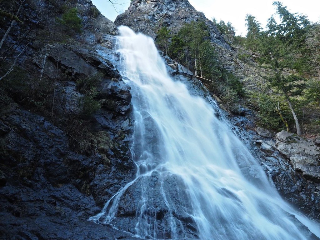
Rocky Brook Falls is not a true hike but a walk of about 200 yards to a beautiful horsetail falls. It is well worth a visit when hiking or visiting in the area.

Rocky Brook Falls

Map & Directions

Trailhead
Co-ordinates: 47.7189, -122.9435 Open in Google Maps

Before You Go

See weather forecast

WTA Pro Tip: Save a copy of our directions before you leave! App-based driving directions aren't always accurate and data connections may be unreliable as you drive to the trailhead.

Getting There

Drive Highway 101 north from Brinnon and turn left on the Dosewallips Road. Drive 3 miles west, park out of the way of traffic. The walk begins on the right after crossing Rocky Brook Bridge.

More Hike Details

Trailhead

Olympic Peninsula > Hood Canal

Olympic National Forest, Hood Canal Ranger District

You can improve or add to this guidebook entry!

Rocky Brook Falls

96 Trip Reports

Hiked here recently?

Submit a trip report!
 
Trip Reports